Before the 1990s, ships in distress relied heavily on Morse code and the hope that another vessel happened to be listening on the same frequency at the right time. The sinking of the Titanic originally prompted international radio regulations, but the system remained technically limited. To eliminate these blind spots, the IMO introduced the Global Maritime Distress and Safety System (GMDSS), fully implemented in 1999.
GMDSS utilizes modern satellite and digital terrestrial technology to ensure that no matter where a ship is on the globe, an automatic distress alert can be transmitted and received by a shore-based Rescue Coordination Centre (RCC) and nearby vessels.
The 4 Sea Areas of GMDSS
Unlike old regulations based on a ship's gross tonnage, GMDSS equipment carriage requirements are determined by the ship's area of operation. The oceans are divided into four distinct Sea Areas:
- Sea Area A1: Area within the radiotelephone coverage of at least one VHF coast station in which continuous DSC alerting is available (roughly 20-30 nautical miles from shore).
- Sea Area A2: Area, excluding sea area A1, within the radiotelephone coverage of at least one MF coast station in which continuous DSC alerting is available (roughly 100-150 nautical miles from shore).
- Sea Area A3: Area, excluding sea areas A1 and A2, within the coverage of an Inmarsat geostationary satellite (roughly between 70° North and 70° South latitude).
- Sea Area A4: Any area outside sea areas A1, A2, and A3 (primarily the polar regions above 70° North and South).
Core Components of GMDSS
A GMDSS console is not a single radio, but a suite of integrated communication devices designed for redundancy:
1. Digital Selective Calling (DSC)
DSC is the heart of GMDSS. It allows ships to instantly transmit a distress alert at the push of a single "Distress" button. The digital burst contains the ship's MMSI (identity), its exact GPS coordinates, and optionally the nature of the distress. This eliminates the need to verbally read out coordinates while the ship is sinking.
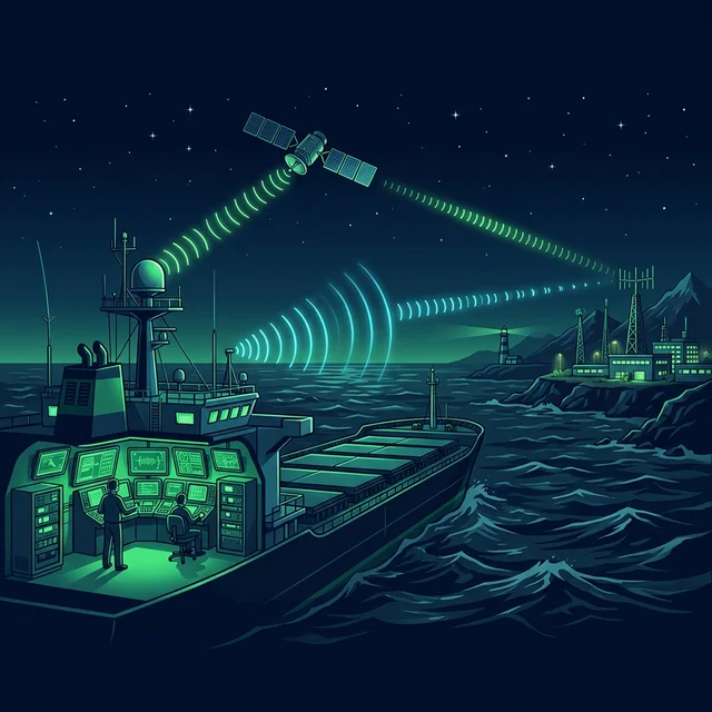
2. Inmarsat & VSAT Satellite Systems
For ships operating in deep oceans (A3), terrestrial radio (VHF/MF) won't reach the shore. Inmarsat terminals provide satellite two-way text/telex (Inmarsat-C) and voice communication, linking the ship directly to global rescue centers.
3. NAVTEX
An automated direct-printing service that receives maritime safety information (MSI). It prints out or displays navigational warnings, meteorological forecasts, and urgent rescue messages for the coastal area the ship is presently navigating in.
4. EPIRB (Emergency Position Indicating Radio Beacon)
A portable, buoyant beacon that automatically releases and floats free if the ship sinks. It transmits a continuous distress signal to the Cospas-Sarsat satellite network, allowing rescue aircraft to pinpoint the wreck's location.
5. SART (Search and Rescue Transponder)
Carried into liferafts, a SART reacts to the radar signals of approaching search vessels by painting a distinctive line of dots on their radar screens, guiding them directly to the survivors.
Sources and verification
Use these references as the starting point for verification; always follow current flag-state, company, port, and approved shipboard documents for operational decisions.
Focus on Communication, Not Calculations
When operating in hostile GMDSS A3/A4 zones, the bridge team must focus entirely on safe navigation and weather intelligence. With CaptainCalc installed on your bridge tablet, complex voyage calculations and draft surveys are processed instantly without requiring an internet connection.