Voyage Planning: Professional Maritime Route Calculator Guide
Voyage planning is the foundation of safe, efficient maritime operations. A well-planned voyage saves fuel, reduces delays, and keeps your crew safe. This comprehensive guide covers everything from route selection to ETA calculation, rhumb line vs great circle, fuel estimation, and weather routing.
Reference basis: IMO/COLREG/STCW concepts, nautical practice, approved ship documents, and CaptainCalc calculation notes. Always verify operational decisions with official sources.
Why Professional Voyage Planning Matters
Real scenario: Two identical container ships depart Singapore for Rotterdam on the same day.
- Ship A: Master plans casually, uses shortest rhumb line route, ignores weather forecasts.
- Ship B: Chief Officer performs professional voyage planning using great circle route, accounts for seasonal weather patterns, optimizes speed for fuel efficiency.
Result after 28-day voyage:
- Ship A: Burned 850 tons fuel, faced 2 storms, arrived 36 hours late.
- Ship B: Burned 720 tons fuel, minimal weather delays, arrived 2 hours early.
- Difference: 130 tons fuel saved × $600/ton = $78,000 profit advantage
This is why professional voyage planning pays for itself immediately.
5 Steps of Professional Voyage Planning
| Step | Action | Deliverable | Time Required |
|---|---|---|---|
| 1. Chart Preparation | Update all navigation charts; note hazards, traffic lanes, restricted areas | Annotated chart with waypoints | 1-2 hours |
| 2. Route Selection | Compare rhumb vs great circle; account for seasonal hazards | Primary & alternate routes plotted | 1 hour |
| 3. Waypoint & ETA Calculation | Calculate distances, speeds, ETAs using vessel characteristics | Passage plan with waypoints & times | 30 min |
| 4. Fuel Estimation | Calculate bunker consumption, margins for adverse weather | Fuel curve and consumption forecast | 30 min |
| 5. Weather & Risk Assessment | Review forecasts, piracy routes, traffic patterns | Risk mitigation plan + contingency routes | 1 hour |
Route Calculation: Rhumb Line vs Great Circle
When to Use Rhumb Line:
- Distance: < 300 nm (coastal voyages)
- Formula: Distance = √[(Δlat)² + (Δlon×cos(lat))²] × 60
- Advantage: Simple, maintains constant compass bearing
- Example: Singapore to Kuala Lumpur (200 nm) = rhumb line
When to Use Great Circle:
- Distance: > 300 nm (ocean passages)
- Benefit: Saves 3-5% distance on long voyages
- Calculation: Uses spherical trigonometry (complex; use calculator)
- Example: Singapore to Rotterdam (7,800 nm)
- Rhumb line = 7,950 nm
- Great circle = 7,650 nm
- Saving: 300 nm = 1-2 days faster
Practical Decision:
Great circle saves fuel, but requires course changes every few hours. Modern ships can handle continuous course adjustments via autopilot, so use great circle for all ocean-going voyages > 500 nm.
Worked Example: Singapore to Rotterdam Voyage
Vessel Data:
- Ship: 20,000 TEU Container Vessel
- Service speed: 21 knots (normal conditions)
- Slow steaming speed: 16 knots (fuel efficient)
- Fuel consumption: 350 tons/day at 21 knots, 220 tons/day at 16 knots
Route Planning:
- Great circle distance: 7,650 nm
- Route: Singapore → Strait of Malacca → Indian Ocean → Suez Canal → Mediterranean → Gibraltar → Atlantic → Rotterdam
ETA Calculation (Normal Speed - 21 knots):
- Ocean passage (7,200 nm): 7,200 / 21 = 343 hours = 14.3 days
- Canal transits (Suez): 12 hours waiting + 12 hours transit = 1 day
- Port operations (loading/discharging): 2 days
- Total ETA: 17.3 days
Fuel Estimation (Normal Speed):
- 14.3 days at sea × 350 tons/day = 5,005 tons bunkers needed
- Safety margin (10%): 5,505 tons
- Current bunkers onboard: 6,000 tons
- ✓ Sufficient fuel (500 ton contingency)
Alternative: Slow Steaming for Fuel Efficiency
- Distance at 16 knots: 7,650 nm
- Time: 7,650 / 16 = 478 hours = 19.9 days
- Fuel: 19.9 days × 220 tons/day = 4,378 tons
- Fuel saved: 5,005 - 4,378 = 627 tons
- Cost savings: 627 tons × $600 = $376,200
- Trade-off: Arrives 2.6 days later (acceptable if no urgent cargo)
Decision Matrix:
| Scenario | Speed | ETA | Fuel Cost | Decision |
|---|---|---|---|---|
| Urgent cargo/high demurrage | 21 knots | 17.3 days | $3,003,000 | Normal speed |
| Flexible schedule | 16 knots | 19.9 days | $2,627,000 | Slow steam (save $376k) |
| Market rate down 15% | 18 knots | 17.8 days | $2,850,000 | Compromise (18 knots) |
Passage Planning Best Practices
Pre-Voyage Planning Checklist
- ☑ All charts updated & corrected
- ☑ Latest Notice to Mariners & Admiralty Notices
- ☑ Weather routing service engaged (SSSG, grib files)
- ☑ Fuel curves & consumption rates verified
- ☑ Canal transit documents prepared (Suez, Panama)
- ☑ Port agents confirmed & ETAs transmitted
- ☑ Crew briefed on dangers, restricted areas, piracy routes
- ☑ Ship Security Plan activated if necessary
Common Voyage Planning Errors
| Error | Consequence | Prevention |
|---|---|---|
| Using outdated great circle tables | ±50-100 nm error on long routes | Use calculator (CaptainCalc) for all routes > 500 nm |
| Ignoring seasonal weather patterns | Route through typhoon/hurricane season | Consult Pilot charts; engage weather routing |
| Underestimating fuel consumption | Run out of bunkers mid-ocean | Add 15% safety margin; account for sea state, wind |
| Forgetting canal/strait transits in ETA | Port expects arrival 2-3 days early | Account for waiting time, pilot pickup, actual transit hours |
| Not checking for piracy routes | Risk to crew & vessel | Check IMO piracy advisories; reroute if necessary |
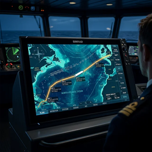
Using CaptainCalc for Voyage Planning
CaptainCalc's Voyage Module automates the entire process:
- Great circle calculation: Automatic for any route > 300 nm
- ETA computation: Accounts for current speed, sea margins
- Waypoint generation: Creates optimal waypoint list
- Fuel estimation: Calculates consumption from vessel curves
- Weather integration: Can import GRIB weather forecasts
- Route templates: Save common routes (Singapore-Rotterdam, etc.)
- Offline operation: No internet required at sea
A professional voyage plan that takes 4-5 hours by hand takes 20 minutes with CaptainCalc.
Related Glossary Terms
- Route Planning - Voyage path selection
- Great Circle - Shortest distance on sphere
- Rhumb Line - Constant bearing route
- ETA - Estimated Time of Arrival
- TTG - Time To Go (remaining voyage time)
- Waypoint - Navigation reference point
- Passage Plan - Formal voyage document
Related Articles
Ender Soyuince has optimized voyage plans for 100+ commercial vessels, resulting in cumulative fuel savings exceeding $2 million. He designed CaptainCalc's Voyage Module to democratize professional-grade passage planning for all maritime professionals.
Related Calculators
Sources and verification
Use these references as the starting point for verification; always follow current flag-state, company, port, and approved shipboard documents for operational decisions.